Home / Lifestyle
Lifestyle
Lake County lifestyle
Water, wine, forest and a calendar of small-town events.
On the water
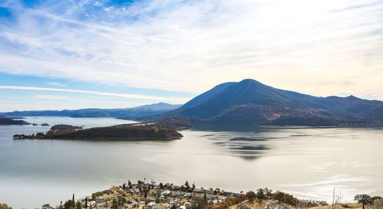
Clear Lake is the largest natural freshwater lake wholly within California, roughly 19 miles long with about 100 miles of shoreline. Boating, jet skiing, wakeboarding, sailing, kayaking and paddleboarding are all part of summer here, and warm-season swimming is popular along the shore.
The lake is also known for bass fishing and is often called the Bass Capital of the West. Anglers also catch catfish, crappie and bluegill. Canal communities such as the Clearlake Keys allow private docks and boat lifts.
About a dozen free public launch ramps ring the lake, and every boat must be inspected and carry a county mussel-prevention sticker before it goes in the water. The lake is also home to the Clear Lake hitch, a native fish found nowhere else, and the shoreline marshes draw grebes, pelicans, herons, egrets, osprey and bald eagles.
A cleaner lake ahead
A long-term effort to improve Clear Lake's water quality is under way. A UC Davis research team is designing a system to add oxygen to the lake's deepest water, which should cut the phosphorus released from the lake bed that feeds summer algae blooms; it is planned to begin operating in 2027. Separately, levees at the north end of the lake are being opened to return marshland and open water near Middle Creek, a project meant to filter runoff before it reaches the lake.
Wine and farms
Vineyards and pear orchards surround Kelseyville and the western and northern shores. The county has more than 20 wineries and roughly 9,000 acres of wine grapes, and the Red Hills, High Valley and Clear Lake wine regions produce wines that pair easily with a day on the lake. Pears and walnuts are long-standing local crops, and farming, tourism and geothermal power are the backbone of the local economy.
Forest and trails
Clear Lake State Park, on the lake's west shore, offers hiking and birdwatching at the foot of Mount Konocti, and the trail up Konocti to the Wright Peak fire lookout gives a view over the whole lake. Anderson Marsh State Historic Park near Clearlake has easy walks through tule marsh and oak woodland. Upper Lake is a gateway to the Mendocino National Forest and the Snow Mountain Wilderness, and Boggs Mountain Demonstration State Forest near Cobb has hiking and mountain-bike trails in the pines.
Events
Lakeport hosts a free summer concert series in Library Park and a Saturday farmers' market. Check the Discover Lakeport calendar for this year's dates, because lineups change every season.
The calendar repeats in a familiar rhythm each year:
- Late spring: the Lake County Wine Adventure, a two-day passport-style weekend of tastings at wineries around the county.
- Fourth of July: fireworks over the lake in Lakeport and Clearlake Oaks, plus parades and street fairs in several towns.
- Labor Day weekend: the Lake County Fair at the fairgrounds in Lakeport.
- Late summer to early fall: the Blue Wing Blues Festival in Upper Lake.
- Last Saturday of September: the Kelseyville Pear Festival.
- Holidays: lighted parades and tree lightings in many of the small towns.
Bass tournaments run on the lake through much of the year. Dates shift from year to year, so confirm before you travel.
Air quality
ALA ranked Lake County #1 for year-round particle pollution in 2013 and 2014. The American Lung Association's annual State of the Air report publishes current rankings. Rankings change from year to year and wildfire smoke can affect any season, so check the latest report before relying on this claim.
Getting here
Lake County is about 110 miles from both San Francisco and Sacramento, usually a drive of two to two and a half hours, and roughly 70 miles (about an hour and a half) from the Pacific coast. The main routes:
- From San Francisco and Marin: US-101 north, then Highway 175 east from Hopland to Lakeport, or Highway 20 east from just north of Ukiah to Upper Lake and the north shore.
- From the East Bay and Napa: Highway 29 north through the Napa Valley to Middletown, usually an hour to an hour and a half from Napa. From there, Highway 29 continues to Lower Lake, Clearlake, Kelseyville and Lakeport, or Highway 175 climbs over Cobb Mountain to Kelseyville.
- From Sacramento: I-5 north to Williams, then Highway 20 west into the county along the north shore.
The closest commercial airports are Charles M. Schulz–Sonoma County Airport in Santa Rosa and Sacramento International. Fiber and 5G coverage vary by address, so verify service for any property you consider.
Facts here are summaries from the sources named and may be out of date. See disclosures.
See it for yourself.
Spend a day at the lake and we will show you the communities that fit.